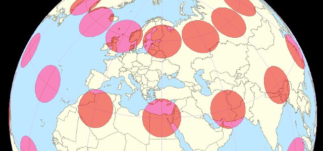
Flat two-dimensional maps are unable to accurately represent the curved three-dimensional surface of the Earth; some distortion of area, shape, distance and/or scale is unavoidable. Tissot’s indicatrix, invented by French mathematician and cartographer Nicolas Tissot, is a method for assessing and indicating the amount of distortion present in a map.
The indicatrix is created by placing an array of tiny circles on the Earth’s surface and then mapping those circles along with the rest of the Earth’s features; the size of the circles is then increased to make them visible.
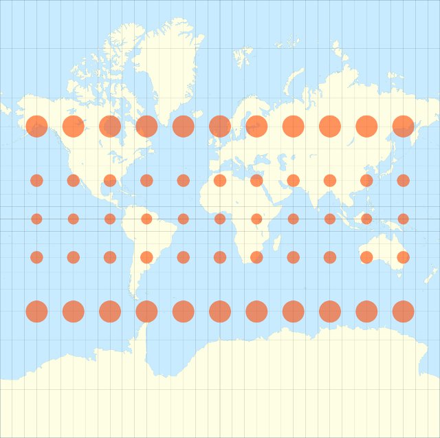
The Mercator projection maintains correct shapes but exaggerates the size of land masses as distance from the equator increases. On the Mercator projection Greenland appears to have a similar area as Africa, despite being only 7% of the size in reality; it also makes Antartica look much larger than it is.*
The equirectangular projection preserves approximate size at the expense of shape: land masses away from the equator are distorted both horizontally and vertically but distances along meridians (lines of longitude) are preserved.
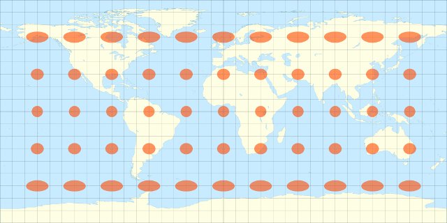
The use of rectangular projections for whole world maps is now widely discouraged; they are considered suitable only for small areas where any distortion will be negligible.
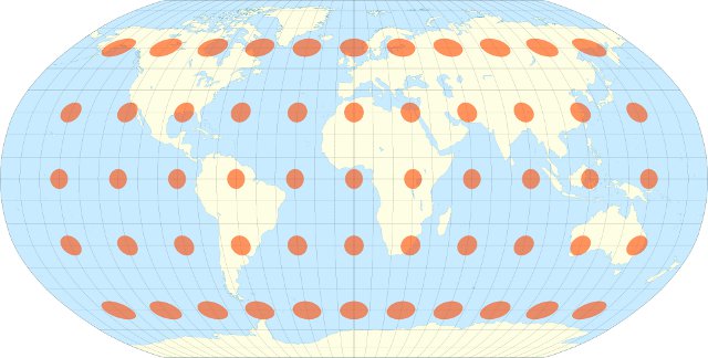
The non-rectangular Robinson and Winkel tripel projections both attempt to find an acceptable compromise between distortions of shape and distance.
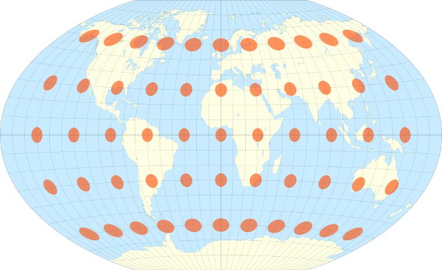
* The Mercator projection’s early popularity was due to its heavy use by sailors – on a Mercator map a constant heading yields a straight line.
Nice publish…i like everything