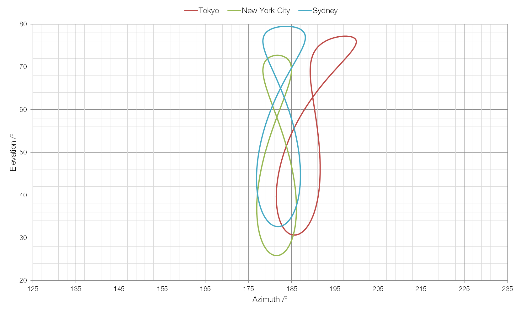
If you took a picture of the Sun every day at noon and then compared the position of the Sun in each of the photographs you’d find that it was in a different place every day. If you joined the positions of the Sun together you’d form an analemma.

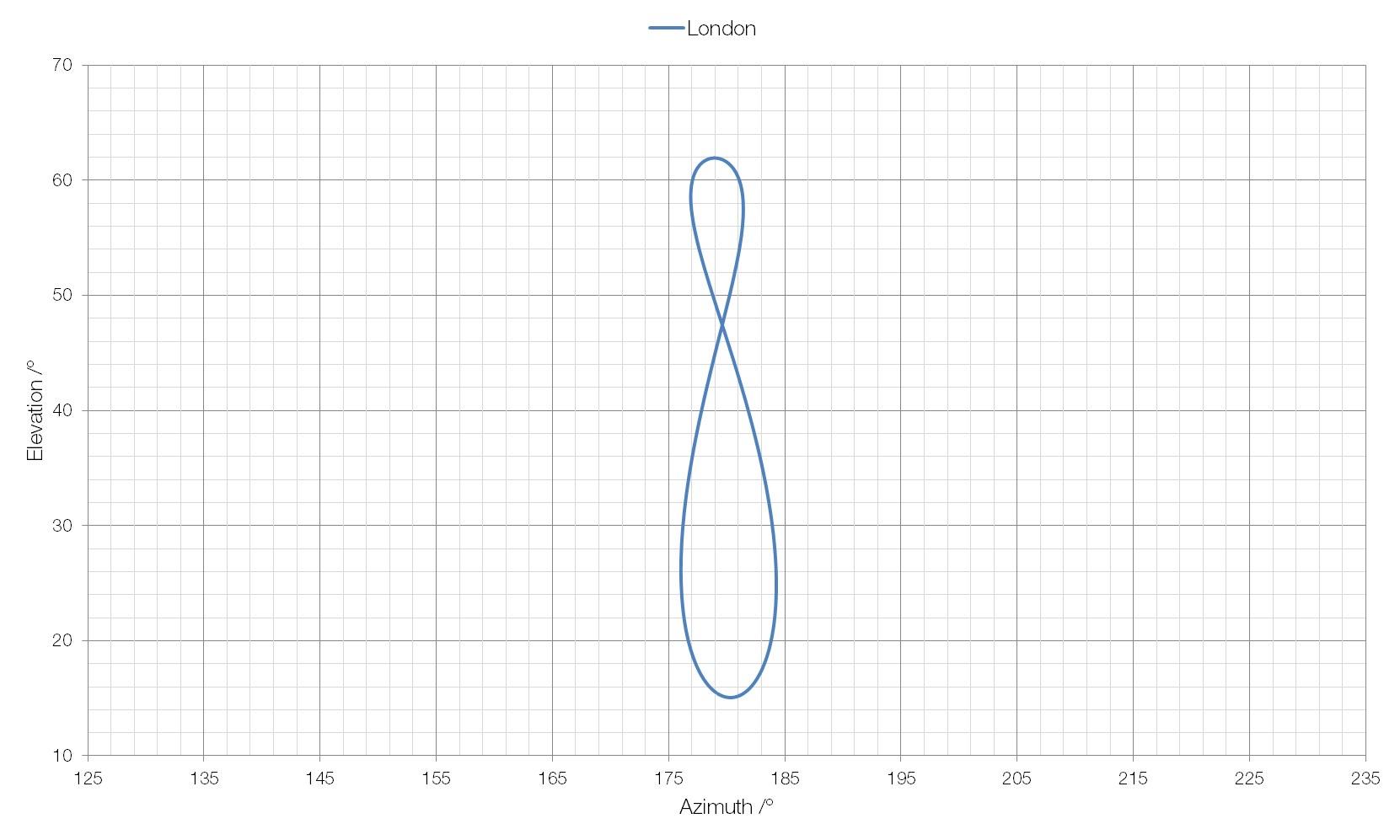
An analemma of the Sun’s position as measured from London is shown above. Elevation, on the y-axis is the angle between the horizon and the Sun, and azimuth, on the x-axis is the compass bearing of the Sun (for example, 90° is due east and 180° is due south).
The shape and size of a solar analemma will vary depending on your position on Earth.
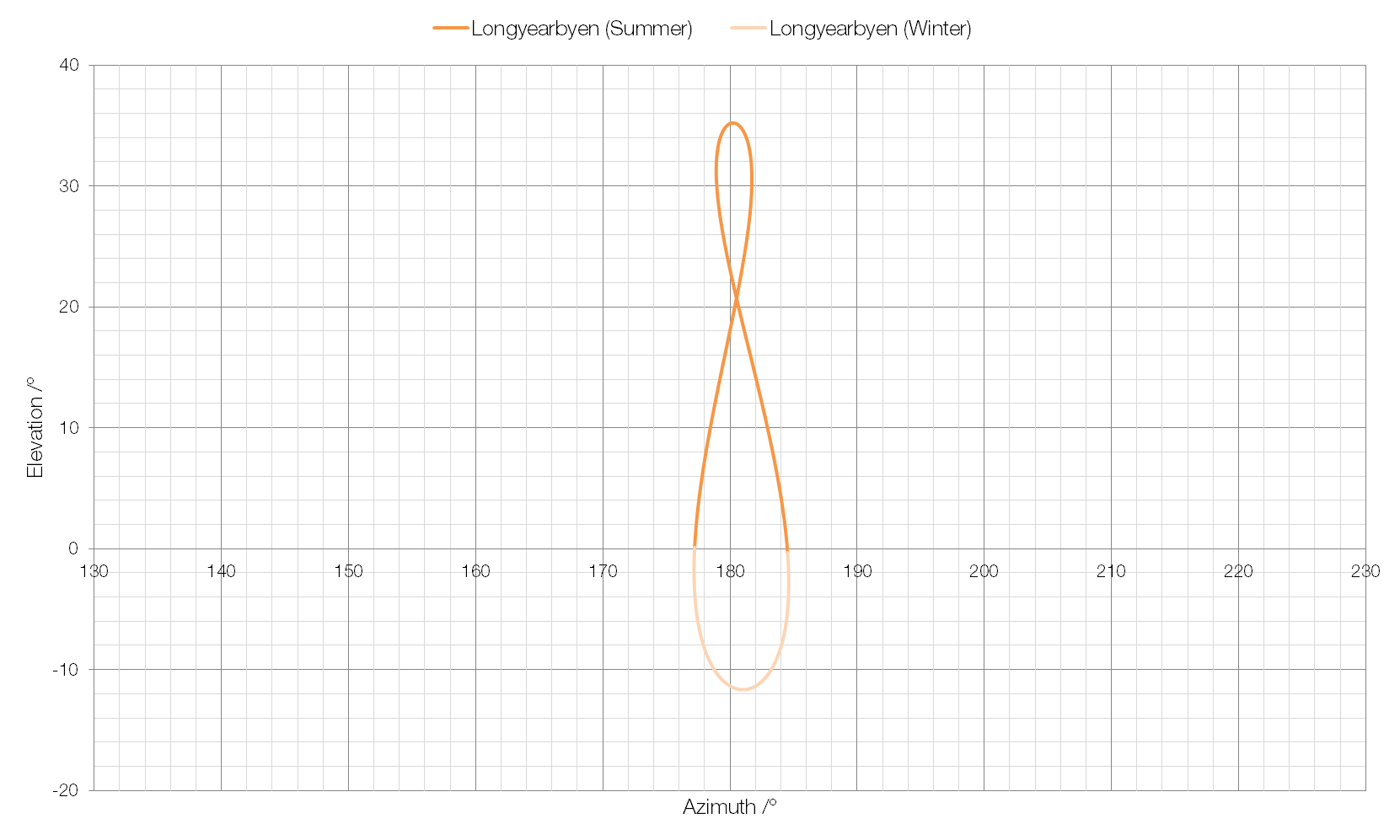
In some cases, such as in Longyearbyen, the world’s northernmost town, the Sun does not rise above the horizon on some days.
At locations near the Tropics of Cancer and Capricorn, for example Muscat in Oman, the analemma has a very “lopsided” shape.
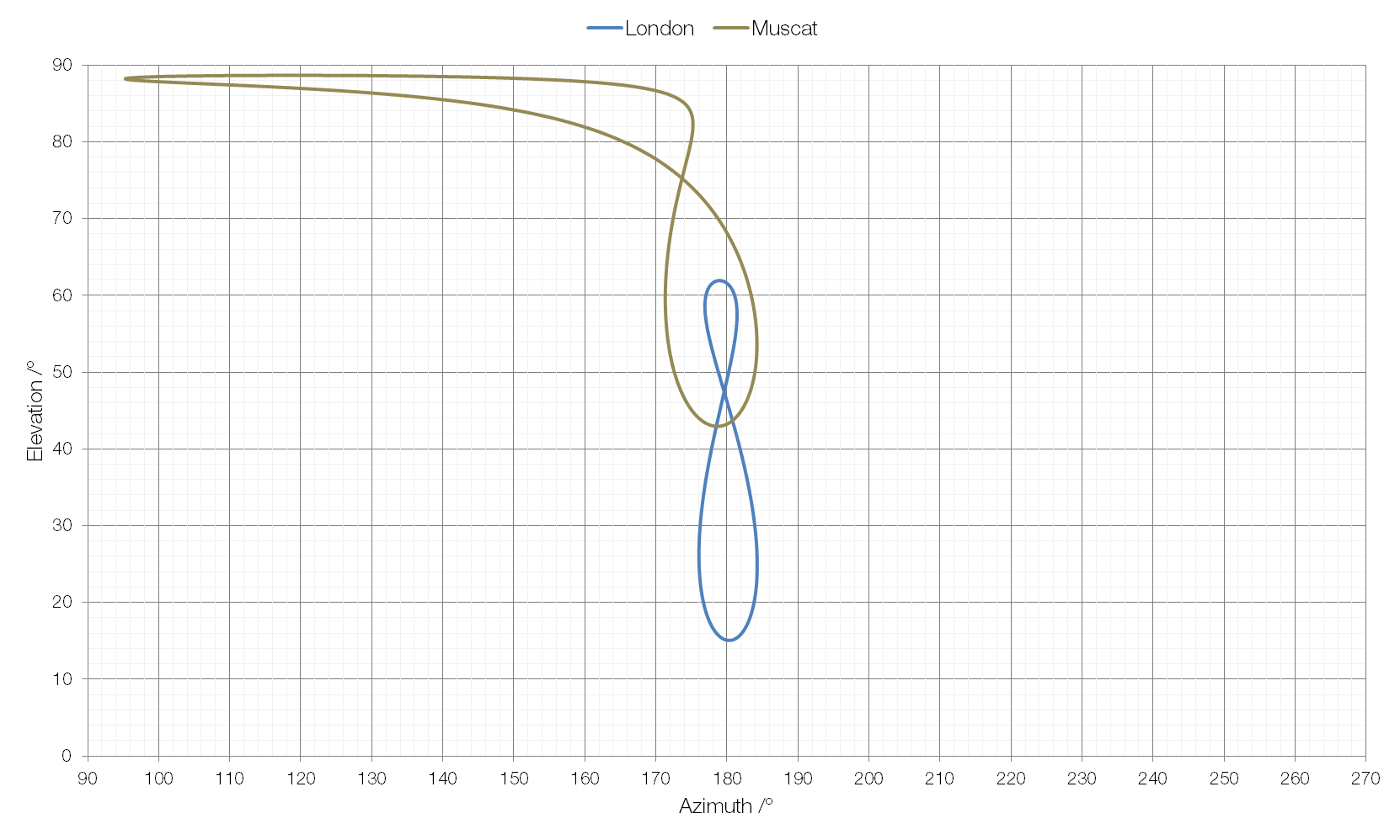
As you can see, at some points in the year (around the Summer Solstice) the Sun is almost due east, even at noon. This is because the Tropics of Cancer and Capricorn are the northernmost and southernmost points respectively at which the Sun can appear directly overhead, and here the Sun rises around east-northeast and sets around west-northwest, rather than east and west. Suncalc allows you to play with location and the time of year to visualise the position of the Sun during the day.
The position of the Sun during the summer solstice as seen from Muscat.